This is just some extra information and photos which didn't fit in the Blog.
On our travels we have come across a fellow driving a F250 with a huge trailer on the back. All decked out in pretty colours. we have seen it at Derby and in Kununurra and the other day at Victoria River Roadhouse. He is travelling around Australia doing videos of his travels.
When we went on the Horizontal Falls trip there was a guy doing a video and he had a little helicopter on the boat. Well it was this same fellow. He built a helicopter from a kit and is moving around Australia with the chopper in the back of the truck. At Horizontal falls he took a video of the area and ray and john are in it in the shark pool. It is on You Tube. Look for Horizontal Falls Seaplane Adventures by a fellow called Graham Harrison. He also has a lot of stuff on his Blog www.aussieheliadventure.blogspot.com
Now here are some photos of some of the wildlife signs we have seen.
Blacks Beach
Sunrise
Wednesday, July 16, 2014
The Bungle Bungles Part 2
After paying our money at the visitors centre we headed to the northern end of the park. First stop was Bloodwood Lookout, or so we thought. It turned out that we walked part of the way to Homestead valley before turning back to find Bloodwood lookout.
This is a view of the escarpment on the way to Homestead Valley.
This is Echidna Chasm with the midday sun shining down into it. The chasm walls are about 200metres high with a narrow opening at the top. The sun gets in between 11am and 1pm each day lighting up the area with brilliant colour
This is the narrow entrance to a deeper part of the chasm. It is only about a 2km return walk into the chasm.
Another chasm view where you have to walk up a small ladder to reach another level of the chasm
You can see in this photo how narrow the path into the chasm is. In the wet season the water would be thundering through here.
Looking back towards the entrance to the chasm from the narrowest part
Maura on the walk back out of the chasm
Ray in Echidna Chasm
This is a view of the escarpment just as you enter the chasm
This is the path into the chasm. You are actually walking on a dry river bed on smooth pebbles of varying sizes. A bit hard on the ankles. You can just imagine what it must be like in the wet season. Completely impassable.
Purnululu National Park (The Bungle Bungles)
John and Margaret flew back to Sydney on Sunday 6th July. We thought their flight went at 1pm so we went to the airport in plenty of time only to find out the flight wasn't until 3.45pm. Virgin hadn't bothered to let anyone know. So we went to Ivanhoe Café for lunch then back to camp for a while until closer to the time. But they did finally get away and got home at last on Monday morning only to find out they had picked up the wrong case at the baggage collection and had to go back to the airport from Penrith to return it. But they are home safe and well and back to work again.
We stayed in Kununurra for another few days to get some shopping and do washing.
We left Kununurra on Wednesday 9th July for the short trip down to the Bungle Bungle caravan Park. The caravan park is a part of Mabel Downs Station and is just off the main road. From the caravan park it is about 53km into the visitors centre of the Purnululu National Park and this takes about 90minutes as the road is pretty corrugated and there are a lot of creek crossings.
We have a great camp spot down at the back of the park. Very quiet.
This is our neighbour at the caravan park. A huge Brahman bull. All he does all day is eat and rest
Here he is on another day having a little rest.
This is our campsite from the air. If you look closely you can see a ring around a caravan on the right. That is us.
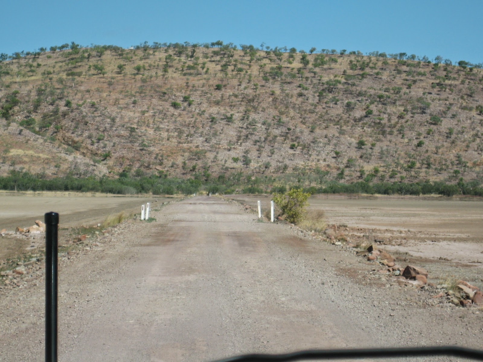
This is the road into the National park from the caravan park
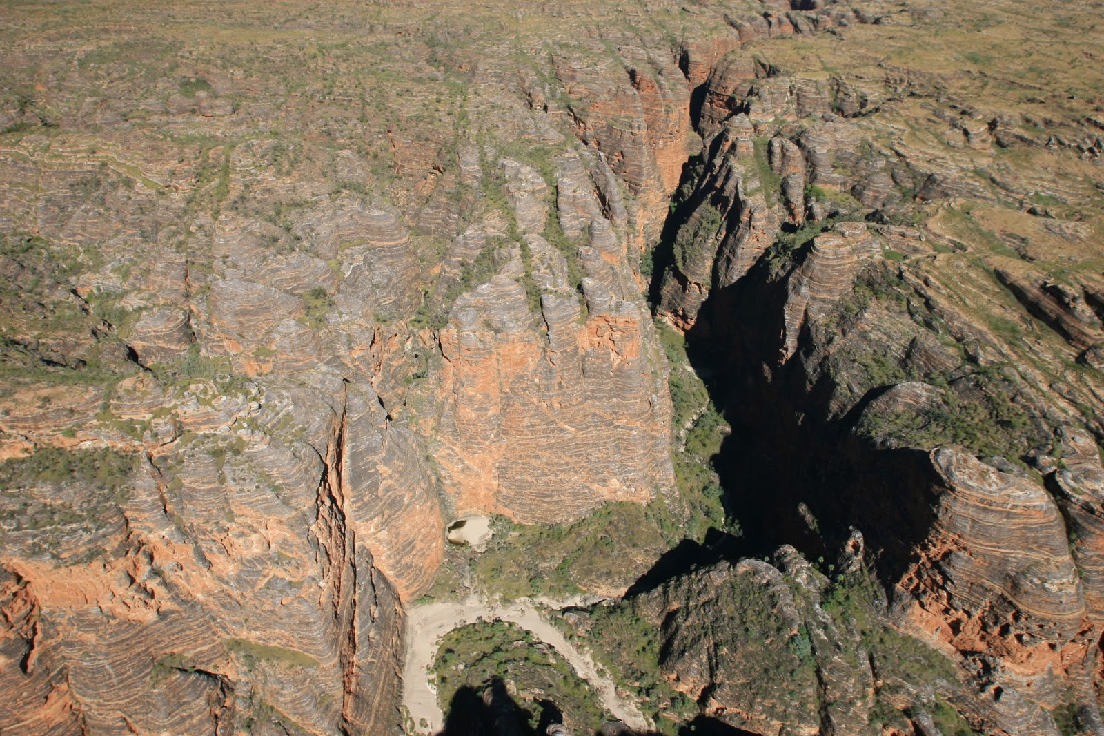
Looking down into one of the gorges from the air. The Bungle Bungle range is renowned for its striking banded domes, the worlds most exceptional example of cone karst formations. They are made of sandstone deposited about 360 million years ago. Erosion by creeks, rivers and weathering in the past 20 million years has carved out these domes, along with spectacular chasms and gorges, creating a surreal landscape.
Looking into the walk into Picaninny Gorge
The Ord River winding through the open country near the Bungle Bungles
Crossing the ranges before getting to the actual Bungle Bungles.
Purnululu National park is 304 km from Kununurra. It covers an are of 239,723 hectares. The Bungle Bungle Range which includes an extraordinary array of banded sandstone domes, covers 45,000 hectares of the park
This is Picaninny Gorge. Overnight trekkers camp on the beach below the range. There are no facilities and no directional signage into this part of the gorge so it is for hardy trekkers only
This area of the park is known as the China wall and stretches to Darwin.
This was our first view of the domes. The domes striking orange and grey bands are caused by the presence or absence of cyanobacteria (formerly known as 'blue green algae' ). Dark bands indicate the presence of cyanobacteria which grows on layers of sandstone where moisture accumulates. The orange bands are oxidised iron compounds that have dried out too quickly for the cyanobacteria to grow.
Looking down into another gorge. The colours are amazing.
And another deep gorge.
You can see where the creek would run during the wet season. During the dry season there are only a few ponds.
This is a mustering yard on the Mabel Downs property
Another view of the Ord River from the air
| This is the helicopter we did our flight in. Note that there are no doors. Great for photo taking but pretty windy. I'll publish this section and do another next as there are a lot of photos. This is our campsite at the Bungles. |
Tuesday, July 8, 2014
Kununurra
Monday 30th June
We got away from Home Valley early before 8am. We crossed the Pentecost River and headed to the end of the Gibb River Road before going to the Kimberleyland Caravan Park at Kununurra.
We had a few things to do while at Kununurra:-
On Tuesday we went for a drive out to Lake Argyle. On the way we spotted Robyn and Danny our friends from the Gibb. We had seen them at Home Valley and they were heading to Lake Argyle and then on to Darwin. But they had a few car problems and had come into Kununurra to see about them. We found out later that they did get them fixed and headed on to Darwin.
Anyway on to Lake Argyle. It is huge. It holds 21 times the water which is in Sydney Harbour and is treated like the open sea from a boating perspective.
We drove down to the dam wall, up to the lookouts and went to the pub for lunch, then had a walk around before heading back to Kununurra.
John and Maura on the dam wall at Lake Argyle
Margaret down beside the water outlet from the lake
Maura and Ray at one of the lookouts with lake Argyle in the background
Looking down where the water is released from the dam to flow down the Ord River to Kununurra. The water then gathers in lake Kununurra to be released for the Ord River Irrigation Scheme.
Margaret and John at the lookout
Part of lake Argyle
Looking out over Lake Argyle
Wednesday 2nd July we headed to Wyndham
The town of Wyndham was gazetted in 1866 and has a history associated with the cattle industry and mining. It was born out of the Halls Creek Gold Rush and in it heyday as many as 10,000 people came ashore here to go hunting for gold. Live cattle export is done from Wyndham now.
Wyndham's major tourist attraction is the 5 Rivers Lookout on top of the Bastion range about 3km from town.
Ray and Margaret at the 5 Rivers lookout
The Cambridge Gulf from the lookout. 5 rivers flow into the gulf, hence the name, the Ord, King, Pentecost, Durack and Forrest Rivers.
Maura and Margaret at the lookout
Looking down on an area where a mining product is brought into Wyndham by boat and then transported to Kununurra by road.
Another view from the lookout
Looking up Cambridge Gulf towards the rivers
Next stop on the tourist trail was the Afghan Cemetery. This cemetery contains the graves of the Afghan settlers and cameleers who provided an important means of transport between the cattle stations and towns of the region. The graves are large due to the lead camel being buried with his master.
The next stop was the Prison Tree. This is a tree where prisoners were held when trekking from Derby to Wyndham. They were able to be kept in the tree while a policeman kept guard outside. Very primitive.
This is the track through the tidal flats
Some burning of the undergrowth was happening. This is done to encourage new grass growth as feed for the cattle. It looks frightening but is quite controlled.
The Prison Tree. You can see the small opening where the prisoners got into the tree.
This is what it looks like inside. This was with a flash.
Ray, Maura, Margaret and John beside the Prison Tree
The sunlight filtering through the branches of the old Boab Prison Tree.
When we got back to our camp there was a small freshwater crocodile down in the water.
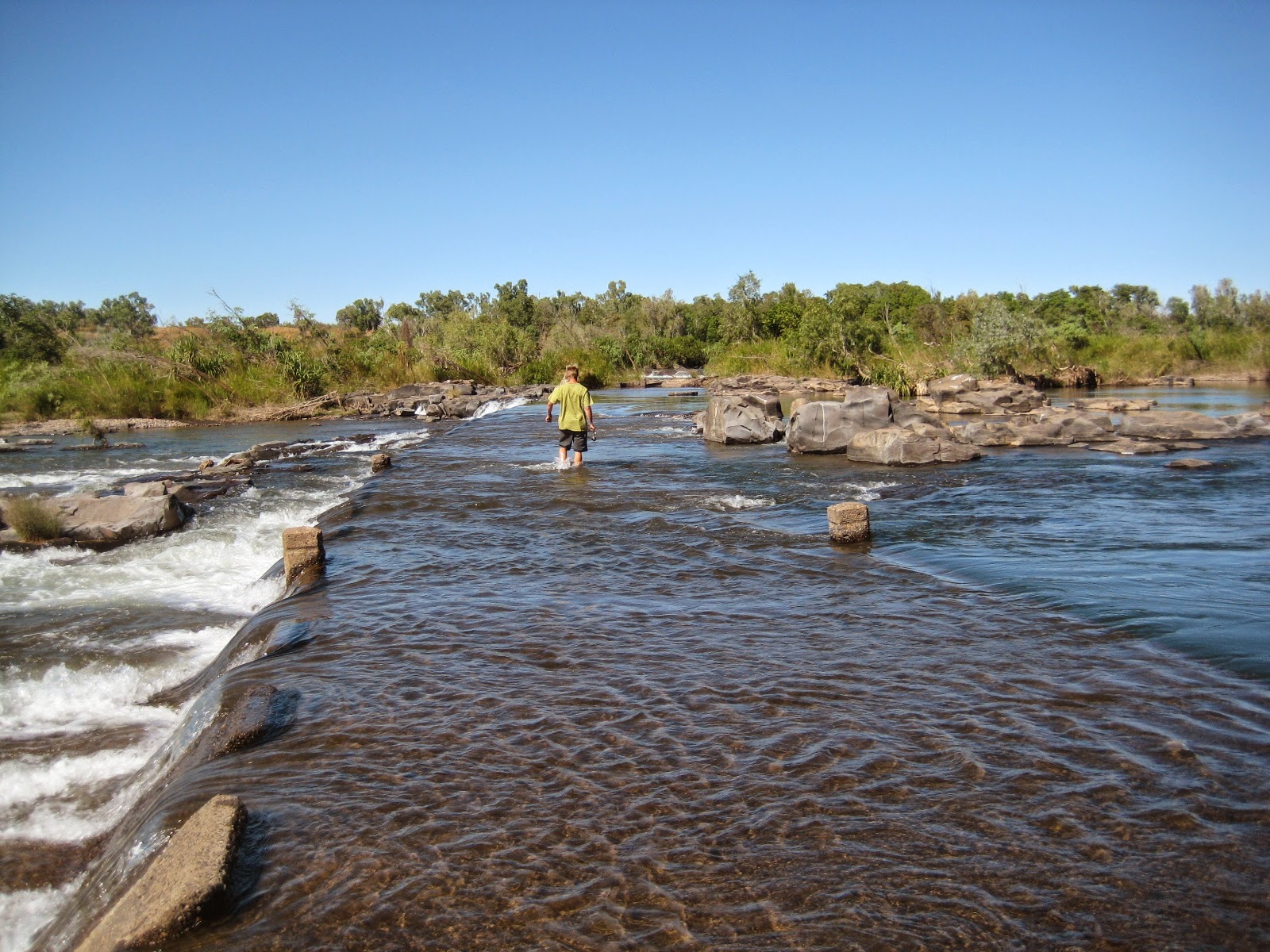
Fisherman wading across Ivanhoe Crossing to try his luck
Ivanhoe Crossing east side. you can see quite a lot of fishermen trying to catch the elusive Barra
We got away from Home Valley early before 8am. We crossed the Pentecost River and headed to the end of the Gibb River Road before going to the Kimberleyland Caravan Park at Kununurra.
We had a few things to do while at Kununurra:-
- Go for a drive to Wyndham and see 5 Rivers lookout, the Afghan Cemetery and the Prison Tree
- Go out to Ivanhoe Crossing, east and west side
- Go up to the lookout
- Go on a sunset cruise on Lake Kununurra
- Go out to Lake Argyle
- Get Ray a wheel alignment - this didn't happen though as the F250 is an in between size and doesn't fit on the car aligner and is too small for the truck aligner. So we will see what can be done in Katherine
On Tuesday we went for a drive out to Lake Argyle. On the way we spotted Robyn and Danny our friends from the Gibb. We had seen them at Home Valley and they were heading to Lake Argyle and then on to Darwin. But they had a few car problems and had come into Kununurra to see about them. We found out later that they did get them fixed and headed on to Darwin.
Anyway on to Lake Argyle. It is huge. It holds 21 times the water which is in Sydney Harbour and is treated like the open sea from a boating perspective.
We drove down to the dam wall, up to the lookouts and went to the pub for lunch, then had a walk around before heading back to Kununurra.
John and Maura on the dam wall at Lake Argyle
Margaret down beside the water outlet from the lake
Maura and Ray at one of the lookouts with lake Argyle in the background
Looking down where the water is released from the dam to flow down the Ord River to Kununurra. The water then gathers in lake Kununurra to be released for the Ord River Irrigation Scheme.
Margaret and John at the lookout
Part of lake Argyle
Looking out over Lake Argyle
Wednesday 2nd July we headed to Wyndham
The town of Wyndham was gazetted in 1866 and has a history associated with the cattle industry and mining. It was born out of the Halls Creek Gold Rush and in it heyday as many as 10,000 people came ashore here to go hunting for gold. Live cattle export is done from Wyndham now.
Wyndham's major tourist attraction is the 5 Rivers Lookout on top of the Bastion range about 3km from town.
Ray and Margaret at the 5 Rivers lookout
The Cambridge Gulf from the lookout. 5 rivers flow into the gulf, hence the name, the Ord, King, Pentecost, Durack and Forrest Rivers.
Maura and Margaret at the lookout
Looking down on an area where a mining product is brought into Wyndham by boat and then transported to Kununurra by road.
Another view from the lookout
Looking up Cambridge Gulf towards the rivers
Next stop on the tourist trail was the Afghan Cemetery. This cemetery contains the graves of the Afghan settlers and cameleers who provided an important means of transport between the cattle stations and towns of the region. The graves are large due to the lead camel being buried with his master.
The next stop was the Prison Tree. This is a tree where prisoners were held when trekking from Derby to Wyndham. They were able to be kept in the tree while a policeman kept guard outside. Very primitive.
This is the track through the tidal flats
Some burning of the undergrowth was happening. This is done to encourage new grass growth as feed for the cattle. It looks frightening but is quite controlled.
The Prison Tree. You can see the small opening where the prisoners got into the tree.
This is what it looks like inside. This was with a flash.
Ray, Maura, Margaret and John beside the Prison Tree
The sunlight filtering through the branches of the old Boab Prison Tree.
When we got back to our camp there was a small freshwater crocodile down in the water.
The next day, Thursday 3rd July we decided to stay local and have a look around Kununurra. First we headed out to the western side of Ivanhoe Crossing. You can't get across anymore for 2 reasons - the water is still too deep and there is a problem with the integrity of the concrete. Lots of people still fish off the crossing and big Barra are caught there regularly.
We then went to the eastern side of Ivanhoe Crossing.
Ivanhoe Crossing west sideFisherman wading across Ivanhoe Crossing to try his luck
Ivanhoe Crossing east side. you can see quite a lot of fishermen trying to catch the elusive Barra
Subscribe to:
Posts (Atom)